Research Lines
How do the three lines of research support spatial design practice?Explore the Research Lines and Meet our Community of Practice
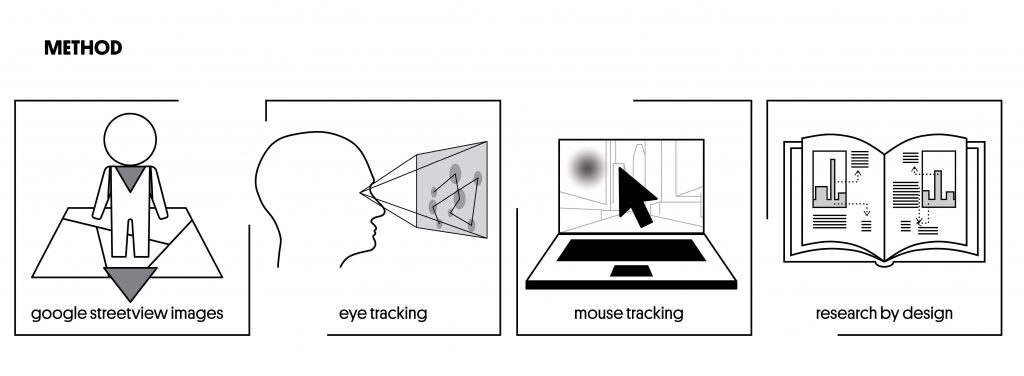
Sensing Streetscapes is a two-year explorative research project that investigates how to design extreme densities within the urban fabric while maintaining a human scale at eye level. The research is composed of three parallel research lines that explore this complex and multidisciplinary topic in a systematic and action-oriented way. Research through Design, Neuroarchitecture and Artificial Intelligence form these three fields of exploration, while a Community of Practice binds these three lines of research together.
What is Neuroarchitecture and How Can It Enhance the Design Process?
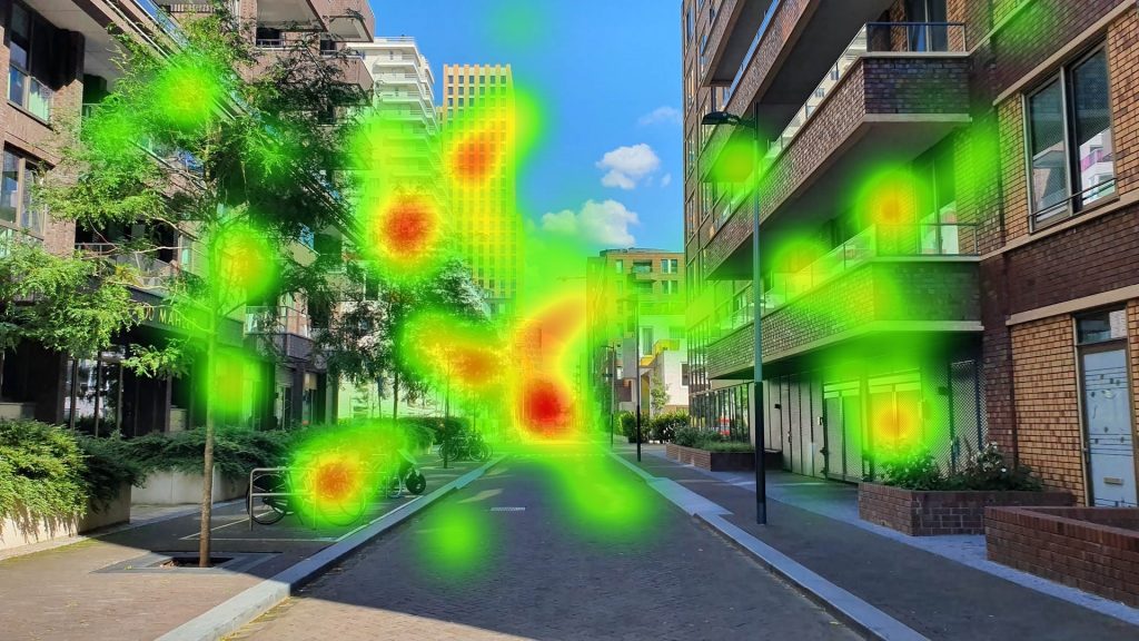
Heatmaps, generated from the aggregated eye-tracking data of participants, help us understand users’ visual experience
The new hybrid field of neuroarchitecture presents novel opportunities. It can provide insights into how we experience architecture by tracking the body’s response to a wide variety of impulses from the built environment. Emerging neuroarchitecture technologies such as eye-tracking, mobile electroencephalography and galvanic skin response offer new biometric pathways to directly measure the impact of the design of the built environment on its users. This technology might confirm the appropriateness of some commonly applied design principles while showing that others should be replaced by principles that measurably increase human well-being.
What Can We Learn from the Designs of Existing Streetscapes across the Globe?
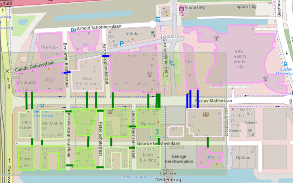
In the practice-oriented Research through Design research line, Sensing Streetscapes consortium partners from nine innovative Dutch urban design and (landscape) architecture firms and the Dutch professional association of urban designers play a central role. This research line applies comparative typo-morphological analysis (Leupen et al. 2010) to systematically analyse streetscapes based on their size, scale, functions, rhythm, form and design. This establishes the typologies of the various coherent spatial-programmatic solutions. These are then translated into design-solution typologies that are applicable in the context of Dutch design practice.
A triple-storey plinth (left) and oriel windows (right), Benjamin Brittenstraat, Amsterdam. They are intended to reduce the scale of the tall buildings
How Can Artificial Intelligence Contribute to the Design Process?
The Artificial Intelligence research line enables designers to use Big Data resources such as OpenStreetMap to easily find relevant reference locations for their own designs
The accelerating growth of big data challenges us to invent new tools and methods so that we can learn from global trends and provide informed design solutions. Artificial intelligence enables us to use computers to mimic human cognitive functions, such as learning and problem-solving (Russell et al. 2010). Applying AI algorithms to the spatial design field presents novel opportunities to discover and explore design precedents in OpenStreetMap. These enormous spatial datasets capture how urban areas evolve, but they are too large and complex to take advantage of their potential. In Sensing Streetscapes, we explore how artificial intelligence can become an integral part of the design process by learning from big datasets and providing valuable insights into 21st-century spatial development.
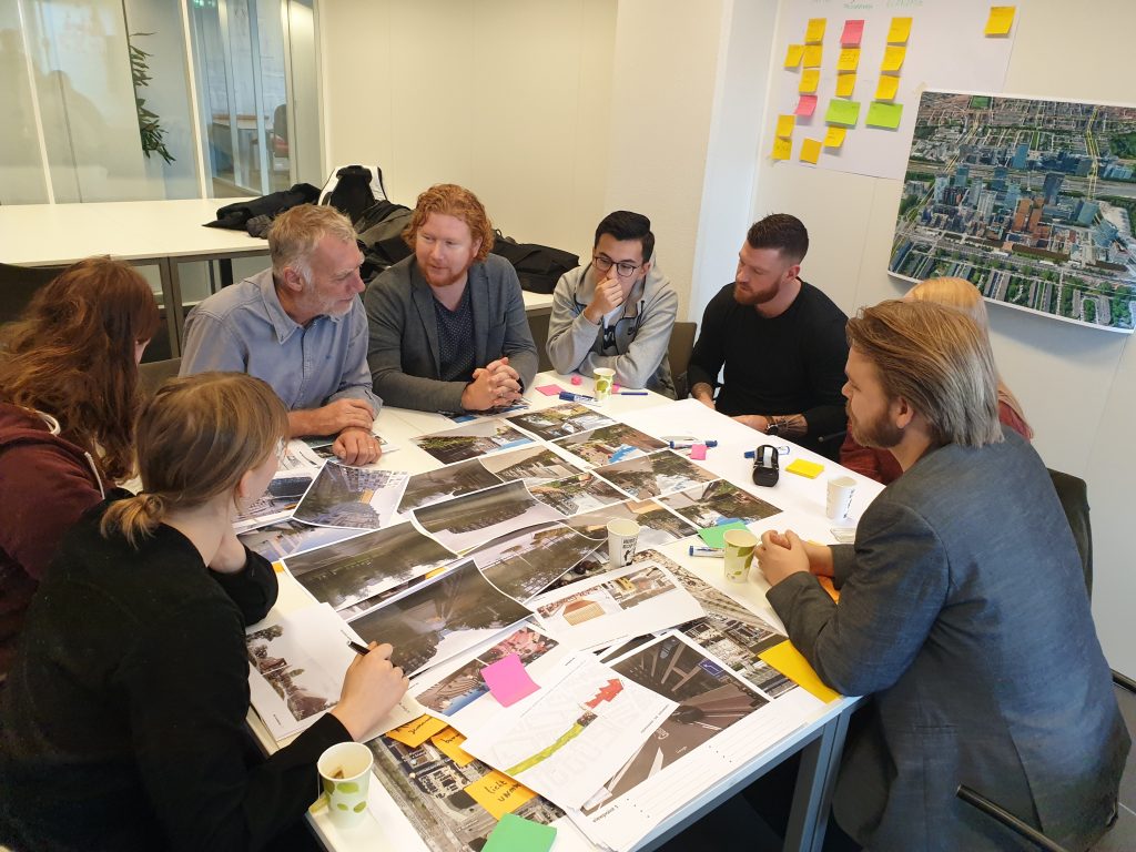
How Do We Collaborate with Our Co-researchers?
In recent years, co-creation and participatory approaches have become an important driving force in urban development and architecture. One advantage of these approaches is that they appeal to the creativity and knowledge of diverse stakeholder groups. Co-creative research, or co-research, can facilitate the creative exploration of emerging technologies and take end-user’s needs into account when design tools and guidelines are being developed.
In the Sensing Streetscapes project, the three lines of research come together in eight co-research sessions held with nine innovative Dutch urban design and (landscape) architecture firms and the Dutch professional association of urban designers.
Co-researchers select the reference images that will ‘feed’ the AI algorithm for finding find the most relevant reference locations for designers