Artificial Intelligence
How can we apply AI algorithms to trace high-density reference locations across the western world?Tracking Urban Reference Locations by Using an Artificial Intelligence Engine
The Artificial Intelligence (AI) research line applies the most recent AI algorithms to explore the value of big data for the spatial design field. The Chair of Spatial Urban Transformation collaborates with the Chair of Big Data in the City, who bring their expertise in AI, algorithms and data analysis to push this exciting interdisciplinary research forward. Sensing Streetscapes applies AI to large datasets, such as OpenStreetMap, to search more quickly for and locate more suitable high-density urban environments as reference locations for your design project than was previously possible. Based on the selected case studies from the Research through Design research line, we are developing an open-access search engine. This engine uses machine learning to recognise the design characteristics of the case studies for an automated search for similar urban developments around the globe.
This calls for a new array of examples and precedent studies of successful existing ‘Great High-Density Environments.’ What are their design properties and how are they programmed? How do they succeed in retaining a human scale? The Chair of Spatial Urban Transformation at the Amsterdam University of Applied Sciences is committed to building an open-access repository. Sharing best practices across the globe is becoming increasingly vital, especially as many of our western cities are on the eve of unprecedented densification.
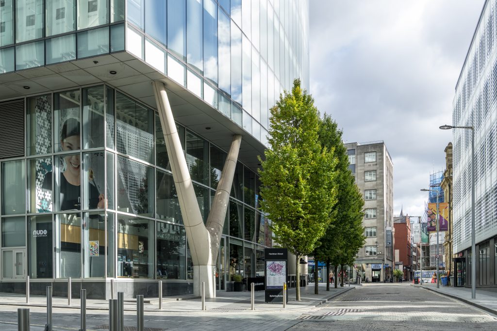
Hardman Street in Manchester is one of the reference locations fed into the self-learning AI algorithm to find similar best practices around the globe, Photo: DavidBurrowsPhotography.co.uk
Machine Learning and AI Enable Designers to Benefit from Big Data Sources
Proposing new and interesting reference locations around the globe that designers can use in their creative process poses exciting technical challenges. We are interested in exploring high-density and high-rise environments with a mixed-use profile of living, working and leisure. Currently, there is no available database that maps all these characteristics across North America and Europe. Therefore, the first challenge is collecting large-scale geographical data in all urban areas in North America and Europe. The research builds on multiple open-data sources such as the Copernicus Urban Center’s dataset, OpenStreetMap and stills from Google Street View. Spatial characteristics, such as size, scale, function and form, are calculated from this data to determine whether a location can potentially serve as a design reference.
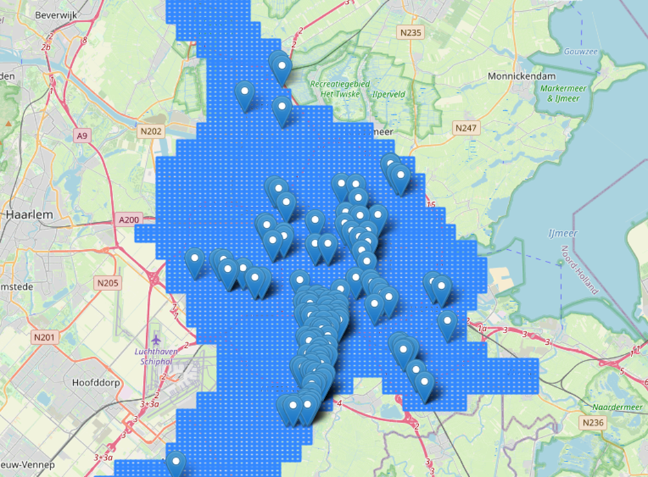
Raster overlay of the urban area of Amsterdam
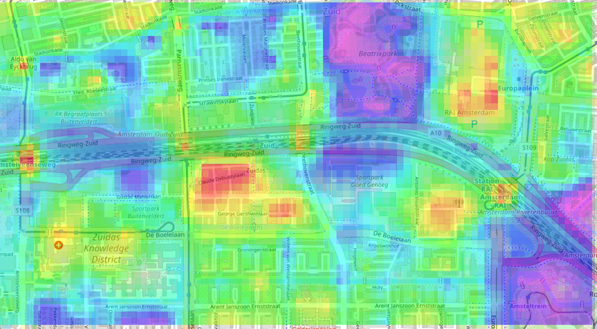
The calculation of ‘open space’ based on the presence of ‘sky’, ‘nature’ or ‘construction’ can enrich the process of finding high-density reference locations. The image shows how little (red) or how much (purple) open space there is in Amsterdam Zuid
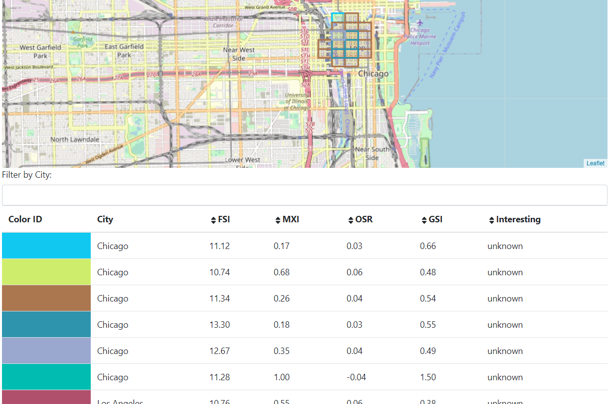
In the second step, we introduce additional algorithms and filters to narrow down the number of potential reference locations. A 250 by 250-metre grid enables us to calculate spatial features for each square. Floor Space Index, Ground Space Index, Open Space Ratio, Mixed Use Index, Street Height/Width ratios, and the number of shops, restaurants or public transport stations are examples of these spatial indicators. Adjacent squares with similar spatial characteristics are grouped together to narrow down even further the most relevant reference. In addition, Sensing Streetscapes builds on cutting-edge knowledge in the field of Computer Vision and object recognition and applies self-learning AI algorithms to explore the streetscapes of the most relevant reference locations.

Discover New Design References with the AI Search Engine
Do you know where the most recent high-density developments are taking place? Would you like to discover new references for your design projects? Through the AI research line, we are building an AI search engine that lets you explore precedents that match your design. The AI search engine allows spatial designers to use a broad range of filters (e.g., Floor Space Index, Open Space Ratio, Mixed Use Index) to trace suitable reference locations across North America and Europe. It therefore brings a richer set of reference locations for design solutions according to local densification challenges.
Click below to use and explore the tool further!
In the online demonstrator, you can search for locations by profiles and/or manually set all filters to your preferences. Profiles are a combination of preselected filters and find the places that meet your criteria. In addition, you can provide an example and search for similar places in western cities. Clicking on a cluster allows you to explore detailed information about an area, while you can also explore the streetscape with the Street View option.
The AI search engine is an interactive AI tool that allows you to search for reference locations across Europe and North America